47.5795, - 97.7926
2020
Location 47.5795, -97.7926 decimal degrees or Drift Prairie transition zone, eastern North Dakota. “Precision farming” underpins much of the industrial agriculture practice in the United States, Canada, Brazil, and elsewhere today.
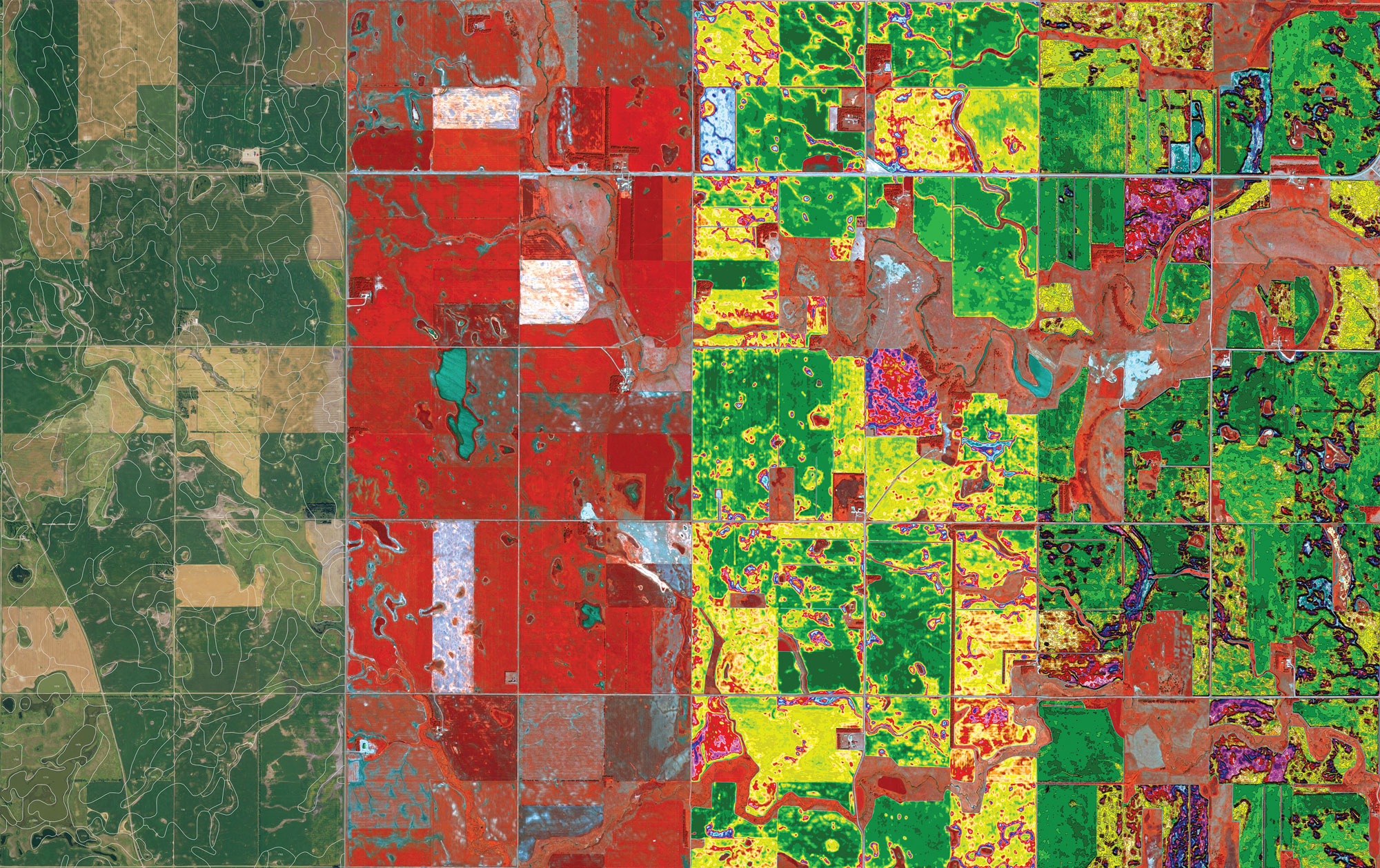
Field and image analytics of precision farming include, from left to right:
Satellite base image with soil lines overlay, from the USDA NRCS SSURGO Soil Survey
Raw multispectral satellite image – used in field analysis by farmers, captured with different spectral bands (red green and blue, and near infrared)
Analysis map revealing biomass densities of plants across fields in different management zones.
Spread map – a black vector line is created around each zone, an export file to be uploaded to the tractor or combine to guide the machine and its application rates for seeds, fertilizer, pesticides; the same maps and data can now determine tillage as well.
Credit:
Satshot (image analytics)
Airbus (multispectral satellite imagery);
Apple Maps (basemap imagery)
Janna Bystrykh, AMO (concept & design)
For the Countryside, The Future exhibition at the Guggenheim Museum, New York